Monday 4 January 2016

George Guest - Macquarie Point, Hobart

George Guest and Mary Bateman and their children arrived in Hobart in November 1805. The family left Norfolk Island aboard the ship, Investigator, on 22 October 1805 for Port Dalrymple at the mouth of the Tamar River. [Norfolk Island 1788-1813 by James Donohoe(1986)] It was planned that these settlers from Norfolk Island would remain on the new settlements in the Launceston area but George Guest decided to move his family to the Derwent where they arrived aboard the ship, Sydney, paying their own passage for the trip. [The forgotten generation of Norfolk Island and Van Diemen's Land by Reg Wright (1986)] Over the next thirty-five years George Guest had a number of allocations of land in Tasmania and when in Hobart, in November 2015, I attempted to find where some of these properties had been located.

On 1 January 1806 George Guest was granted 24 acres at Macquarie Point, Hobart Town.
 In 2012 a study was made of the Macquarie Point area and the Macquarie Point Development Project Historical Summary was published in January 2013. The area in red shows the location of the first land grants to George Guest (24 acres) and to Leonard Fosbrook (14 acres). This area of land was initially named Fosbrooks Point.
In this 1824 map of the original holdings, George Guest's land is the top section indicated. Fosbrooks Point was renamed Macquarie Point when Governor Macquarie visited the colony in November 1811.

The land was granted to George Guest and Leonard Fosbrook for the growing of crops to help increase the supply of fresh produce for the new colony. George and his family did not live on this land but lived in a building on additional land granted to them in nearby Campbell Street.
Macquarie Point Development Office
I went for a walk to the docks and then continued down Evans Street past the warehouses and wharves that border the city side of Macquarie Point until I reached Davey Street which then became Tasman Highway.  I continued on towards the Cenotaph. On the right was the office of the Macquarie Point Development Project.
Looking through the fence it was possible to view some of the land that makes up Macquarie Point.
From the hill near the Cenotaph it is possible to look over the development on the present site.
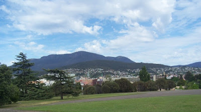
Mountain view from near Macquarie Point
Edward Lord (no relation to my Lord family members) purchased Fosbrook's land on 1 January 1814. The Government began to acquire the land at Macquarie Point in 1821. George Guest had already sold his land in this area to Edward Lord who exchanged the Macquarie Point land for 10,000 acres of land elsewhere.
The actual completion of the project on Macquarie Point will not occur for another 10 or 15 years. A Master Plan has been developed and it is planned to seek expressions of interest from developers this year (2016).

No comments:

Post a Comment